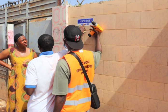
The Kanifing Municipal Council (KMC) has commenced a mapping and property identification exercise of homes and businesses in collaboration with the ???????? ?? I?????????? and ????????????? ??????????????.
The exercise will create a comprehensive system to locate properties and navigate within the municipality, a statement by KMC said.
The statement added: “KMC has established a ?????????? ??????????? ?????? (GIS) unit, which is leading this mapping exercise. KMC has a functional ?????????? ??????????? ?????? (GIS) that utilises spatial and geographic data to enhance service delivery in the municipality. The GIS unit uses this spatial data to create maps of the municipality.
“In order to located properties within the municipality, KMC’s GIS unit started collecting data on 1st of June 2021. The unit has commenced tagging properties in the municipality with a unique identifier referred to as a GOOGLE PLUS CODE. An example of a Google Plus Code is F89C+HR5, Bakau, which refers to Independence Stadium in Bakau. Residences are encouraged to type these codes into Google Maps, in order to see their location on a phone or computer.
“The data collection exercise is expected to be concluded by the end of October 2021, at which point every residence and business in Kanifing municipality shall have a unique code for identification purposes.
“The enhanced GIS system and introduction of Google Plus Codes will improve access to information for planning purposes, enhance communication with fire services and medical ambulances regarding one’s location in times of emergency, and improved business operations, especially for financial institutions, logistics companies, and delivery operators.”


